Home › Festivals › Gyeryong Military Culture Festival
Gyeryong Military Culture Festival
- 📅 Dates
- Oct 1, 2026 – Oct 5, 2026
- 📍 Location
- 96, Gyeryongdae 9-ro, Sindoan-myeon, Gyeryong-si, Chungcheongnam-do
- 🎫 Admission
- Free
- 🕘 Hours
- 09:00-17:00
- 🎪 Venue
- Gyeryongdae Runway and various locations across Gyeryong-si
- 🏛️ Organizer
- Gyeryong-si · Gyeryong City Foundation for Culture & Tourism
- ☎️ Contact
- +82-42-840-2621~4
⚠️ This festival's listed dates have passed
The dates above are from the most recent official schedule. Many Korean festivals are annual events held around the same time each year, but the next date has not been officially confirmed yet — please check the official website or a Google search below before planning a trip.
Overview
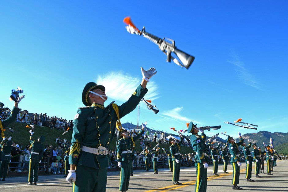
*The information below is based on the 2025 festivals. Details for the 2026 festivals will be updated as they become available.*Gyeryong Military Culture Festival, one of Korea’s prestigious festivals, features various performances, including an opening act and military culture concert with rock, trot, and K-pop acts. In addition, military band performances, road parades, and various hands-on experience programs are held, offering diverse content that can be enjoyed by people of all ages.
Source: Korea Tourism Organization (official English translation, TourAPI).
What happens at Gyeryong Military Culture Festival
- Military Culture Festa Concerts (Rock
- Trot
- and K-pop)
- Yongdoryeong Circulating Train
- Survival Combat Experience
- Military Training Experience
- and more
Official programme as registered with the Korea Tourism Organization for the most recent edition. Details can change — check with the organizer before you go.
🇰🇷 Copy this into Naver Map or Kakao Map
Google Maps cannot give walking or transit directions inside Korea — Korean law restricts map-data export. Naver Map and Kakao Map can, but they find far more when you search in Korean. Copy and paste:
📊 How busy this area gets
Visitor-volume index for 계룡시, from Korea Tourism Organization big data. 1.00 = that area's own yearly average, so this compares the area against itself — not against Seoul.
Oct — 1.15 · quietest of the months we have
The index covers the whole district, not the festival ground itself. Use it to pick a month, not a day. · Aug 1.15 / Aug 1.15
🅿️ Nearby attractions — with actual parking capacity
Most sites only say "parking available." These are official figures from the Ministry of the Interior and Safety, so you can judge before you drive.
Names and addresses here stay in Korean on purpose. Google Maps cannot give directions inside South Korea, and NAVER Map / KakaoMap find these places only under their Korean names — copy an address above and paste it straight in.
🏮 Traditional market days during the festival
Korean country markets open only on days ending in fixed digits — every 5 days. These are the actual dates they open while the festival runs, so you can add one to the same trip.
Names and addresses here stay in Korean on purpose. Google Maps cannot give directions inside South Korea, and NAVER Map / KakaoMap find these places only under their Korean names — copy an address above and paste it straight in.
🎪 Other festivals nearby at the same time
Overlapping dates, within 60 km.
Nearby Attractions
Places near the festival venue, described in English by the Korea Tourism Organization. Distances and times are road-based driving estimates from NAVER route search — useful for taxi trips — and can change with traffic. Places under 1 km in a straight line are marked “walkable”. Anything more than 15 km away by road is left out.
-
Korean Natural History Museum한국자연사박물관 Cultural facilityapprox. 7.8 km · ~12 min by car
The Korean Natural History Museum showcases Korea's plants, animals, insects, and rocks. It includes exhibition halls, a cafe, and a theater. The main attractions are…
Korean address for map apps충청남도 공주시 반포면 임금봉길 49-25 -
Gyeryongsan National Park계룡산국립공원 Attractionapprox. 8.1 km · ~13 min by car
Gyeryongsan National Park stretches across the cities of Daejeon, Gongju, and Nonsan in Chungcheongnam-do and was made a national park on December 31, 1968. The name of…
Korean address for map apps충청남도 공주시 반포면 동학사1로 327-6 -
Donghaksagyegok Valley동학사계곡 Attractionapprox. 9.3 km · ~17 min by car
Donghaksagyegok Valley is a 3.5-kilometer-long valley located near Donghaksa Temple within Gyeryongsan National Park in Gongju. It is surrounded by lush green forests…
Korean address for map apps충청남도 공주시 반포면 학봉리
Google Maps cannot provide driving or transit directions inside South Korea. Paste the Korean addresses above into NAVER Map or KakaoMap — both work with these addresses and are what people here actually use.
Other festivals in Chungnam
← Browse all festivals in Chungnam
Taking the trip home
A small Korean brand called kory puts city names on everyday things — hair rollers, hair ties, claw clips, scarves.
We help make kory, so this is not a paid placement — but it is a link we have an interest in. That is why it sits here at the bottom and nowhere else. Product pages and the shop home are in English; a few other pages there are still Korean only.