Home › Festivals › Guardians of Jinju
Guardians of Jinju 2026
- 📅 Dates
- Oct 3, 2026 – Oct 18, 2026
- 📍 Location
- 287 Gangnam-ro, Jinju-si, Gyeongsangnam-do
- 🎫 Admission
- 5,000 won
- 🕘 Hours
- 13:00-21:00
- 🎪 Venue
- Jinjuseong Fortress
- 👥 Age
- 전 연령
Overview
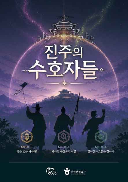
Guardians of Jinju is a mission-based tour set around Jinjuseong Fortress and the Jinju Battle History Culture Park. Participants can enjoy the content simply by accessing a web-based platform, without having to install a separate app, and move between designated locations within Jinjuseong Fortress and the Jinju Battle History Culture Park to complete missions. The content consists of a three-part series. Part 1 features story-driven missions based on historical events that took place at Jinjuseong Fortress. Part 2 takes the form of a mystery, with the story unfolding around three characters.
Source: Korea Tourism Organization (official English translation, TourAPI).
What happens at Guardians of Jinju
- Evening mission-based tour
Official programme as registered with the Korea Tourism Organization. Details can change — check with the organizer before you go.
🇰🇷 Copy this into Naver Map or Kakao Map
Google Maps cannot give walking or transit directions inside Korea — Korean law restricts map-data export. Naver Map and Kakao Map can, but they find far more when you search in Korean. Copy and paste:
Paid linkBoth apps need mobile data while you are out and about. A Korea eSIM can be bought before you fly → Compare Korea eSIMs on KlookWe earn a commission if you book through this link. Your price is the same.
🅿️ Nearby attractions — with actual parking capacity
Most sites only say "parking available." These are official figures from the Ministry of the Interior and Safety, so you can judge before you drive.
Names and addresses here stay in Korean on purpose. Google Maps cannot give directions inside South Korea, and NAVER Map / KakaoMap find these places only under their Korean names — copy an address above and paste it straight in.
🏮 Traditional market days during the festival
Korean country markets open only on days ending in fixed digits — every 5 days. These are the actual dates they open while the festival runs, so you can add one to the same trip.
Names and addresses here stay in Korean on purpose. Google Maps cannot give directions inside South Korea, and NAVER Map / KakaoMap find these places only under their Korean names — copy an address above and paste it straight in.
🎪 Other festivals nearby at the same time
Overlapping dates, within 60 km.
Nearby Attractions
Places near the festival venue, described in English by the Korea Tourism Organization. Distances and times are road-based driving estimates from NAVER route search — useful for taxi trips — and can change with traffic. Places under 1 km in a straight line are marked “walkable”. Anything more than 15 km away by road is left out.
-
Jinjuseong Fortress진주성 Attraction0.5 km straight · walkable
Jinjuseong Fortress, initially erected in ancient times, was expanded in 1379 to fend off pirate invasions. It saw two battles during the Imjin War (1592-1598). Inside,…
Korean address for map apps경상남도 진주시 남강로 626 -
Somangjinsan Lantern Theme Park소망진산 유등테마공원 Attraction0.9 km straight · walkable
Somangjinsan Lantern Theme Park was created to display the history and culture of the Namgang River and Jinjuseong Fortress through lanterns, the focal point of the…
Korean address for map apps경상남도 진주시 망경동 -
Jinju Bullfighting Arena진주소싸움경기장 Travel courseapprox. 6.4 km · ~14 min by car
Jinju Traditional Bullfighting Arena was established with the aim of preserving and fostering Jinju's traditional folk culture of bullfighting. With a seating capacity…
Korean address for map apps경상남도 진주시 판문오동길 100 -
Jinyangho Park진양호 공원 (진양호 전망대, 동물원 Attractionapprox. 7.2 km · ~14 min by car
Jinyangho Park is situated around Jinyangho Lake, the only manmade lake in Gyeongsangnam-do. The park is complete with a range of facilities and amenities, including a…
Korean address for map apps경상남도 진주시 남강로1번길 96-6 (판문동) -
Gangju Pond강주연못 Attractionapprox. 11.7 km · ~18 min by car
Gangju Pond is the orgin of the current Jinjuseong Fortress. It is unknown when the pond was first built, but the trees that grow around the pond are 500-600 years old,…
Korean address for map apps경상남도 진주시 정촌면 예하리
Google Maps cannot provide driving or transit directions inside South Korea. Paste the Korean addresses above into NAVER Map or KakaoMap — both work with these addresses and are what people here actually use.
Other festivals in Gyeongnam
← Browse all festivals in Gyeongnam
Taking the trip home
A small Korean brand called kory puts city names on everyday things — hair rollers, hair ties, claw clips, scarves.
We help make kory, so this is not a paid placement — but it is a link we have an interest in. That is why it sits here at the bottom and nowhere else. Product pages and the shop home are in English; a few other pages there are still Korean only.